

Digital Choke Daynotes |
What's a Daynote?"Daynotes" are daily (usually) journal entries of interesting happening and discussions. They are not 'blogs', which are often just a collection of links to other information (although we do include links occasionally). Daynotes are much more interesting (we hope). These "Digital Choke Daynotes" were inspired by the collection of daily journals of the "Daynotes Gang" (see sites at .com, .net), a collection of daily technical and personal observations from the famous and others. That group started on September 29, 1999, and has grown to an interesting collection of individuals. Readers are invited and encouraged to visit those sites for other interesting daily journals. If you have comments, send us an email. A bit more about me is here. You might also enjoy our little story about the death of the 'net. |
Reports
|
Thursday: drive to Salt Lake City. Easy directions from the map program. Enter Interstate 80 East. Go 625 miles. You're there.
Along the way I snapped some pictures of interesting places. All were done out of the window as I drove down the highway at 75mph (posted speed limit in most of Nevada and western Utah).
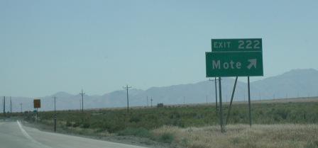
| This is a little place in Nevada. Not much to it. |  |
| A bit farther down the road. Not much bigger than Mote. |  |
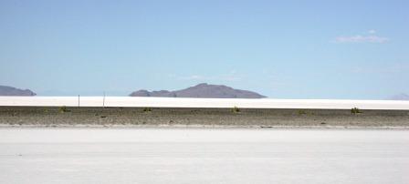
| A view of the salt flats just east of Wendover NV/UT, about mile marker 20. Although hard to see, the island out there looks like it is floating in the water. |  |
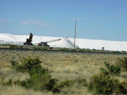
| One of the salt processing plants. That white mountain in back of the equipment is all salt. |  |
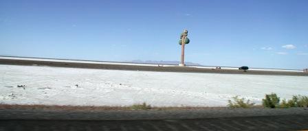
| At milepost 26, just east of the Nevada/Utah state line, is this large "art" piece. It is a tower with several round objects on it. I've never figured out what it is, or why it is there. Although there is a plaque on the tower, there are "no parking" signs on the side of the road next to it. |  |
I didn't get a picture of Beverly Hills, Nevada. It looks like a couple of house in a bunch of trees in the middle of the Nevada high desert. There is some interesting scenery for that trip. Although much of it looks the same.
On the Katrina front, some really clever usage of the Google Map API here http://mapper.cctechnol.com/floodmap.php . You can click on any area of the map and see max and current floodwater depth. Quite fascinating.
And for security:
All three are recommended for those that are affected.
Busy times. Working on some web auditing reports at work. Crystal Reports is irritating me at the moment. I'm not getting all the data from the database, and haven't figured out why.
And I was trying the Novell NDS ODBC in Crystal Reports, and can't get the tables loaded into a new reports. I posted a message on their forums, but no response yet.
A bit of cleanup on my work computer hard drive. Seems there's a 80GB disk that is 97% full. Probably the reason for slow response there, eh? So I am doing a bit of pruning to get rid of some old stuff. Most of the space is taken up by some vmWare testing partitions that I don't need anymore.
On tap this weekend might be a bit of backyard planting work. The weather is turning to fall; much cooler now, with temps from 55-85 degrees F. So I'm thinking, in my amateur gardening thoughts, that it's getting to be a good time to plant some new ground cover. A trip to Lowe's tonight with Pam after dinner (another hot date!) to look for some likely candidates. Then another 8-10 bags of shredded bark, and perhaps some small stones. The back yard planting area has small stones around the edges of the patio, with drainage pipes there. Might be a good idea to clean out that stoned area.
That should keep me busy enough. Although I do have some serious nap time scheduled for tomorrow.
... more later ...
|
||||||
|
Visitors
| ||||||